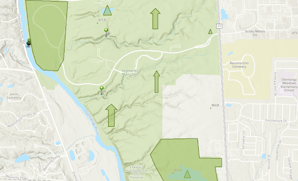
GIS Map
Highbanks Metro Park
Above is a GIS map of Highbanks Metro Park in Columbus, Ohio. The park features many unique landscapes and habitat areas. the large shaded area on the top represents the prairie grass habitat and the lower shaded area represents the wetlands found in the park. The vertical arrow represents forested areas of the park. Most of the park is forested. The triangles represent ponds, the two pushpins in the middle represent tributaries and the larger pushpin represents the Olentangy river. Overall it was fairly simple to use the only mapping software. I have some familiarity with ArcGIS as I have taken a class for it in undergrad, however, the online version is a little different. I enjoyed looking through the various layers and tools that are available with the software.


Comments
Post a Comment